Meritage Homes | Avondale, AZ
The Entrada development is a 240-acre residential sub-division under development by Willis Properties with approximately 830 single-family lots planned. The developer retained the EPS Group team to study the existing watershed and the corresponding drainage impacts of the planned development and design the drainage infrastructure required to handle stormwater as it flows through the site.
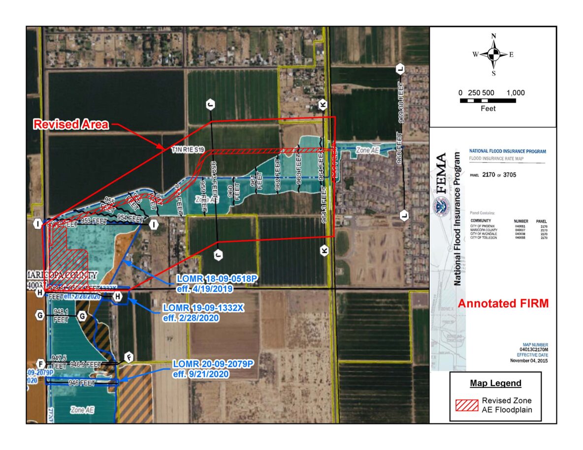
The property is located at the northwest corner of Broadway and 107th Avenue in Avondale. It is impacted by the regional drainage collected and conveyed in the Durango Regional Conveyance Channel, which is a flood control project. Our team worked with the cities of Avondale and Phoenix, as well as the Flood Control District of Maricopa County, to obtain approvals from all three agencies for extending the Channel to resolve the floodplain issues on the project.
Developing a 2-D Hydrologic Model
EPS Group developed a two-dimensional hydrologic model (FLO-2D) to account for the distributed flow patterns, attenuation at roadways, and within developed areas of the watershed. The model accounted for spatially varied rainfall depths, infiltration loss parameters, 45 existing culverts, and included over 532,000 20-ft grid cells with elevations set using available 0.5-m LiDAR topographic data.
Our team also developed a separate two-dimensional model using HEC-RAS to analyze the existing site conditions and to size and design the proposed drainage infrastructure at the site. The “RAS2D” model uses upstream inflow hydrographs from pre-defined FLO-2D floodplain cross-sections and also accounts for local rainfall runoff using the “Rain-On-Grid” precipitation based upon excess rainfall depths. We updated the local RAS2D model with detailed breaklines and proposed terrain grading models to provide more accurate flow depths and velocities for the grading design. Site modifications were made to account for potential erosive areas with adequate freeboard adjacent to conveyance corridors.
With a sound hydrologic analysis and appropriate drainage infrastructure design, Entrada will bring much-needed housing to Arizona’s expanding population in the City of Avondale and will convert land previously used for agriculture into prime real estate in the Phoenix metro area.
Critical Issues
Regional drainage facilities convey runoff to the Entrada development project site, creating a natural and regulatory floodplain over a portion of the site. By extending the Durango Regional Conveyance Channel, the floodplain issues are resolved. Given its location and the floodplain, the project requires review and approvals from both City of Avondale and Phoenix, as well as the Flood Control District of Maricopa County. Each is an administrator of a portion of the floodplain being revised by the project, therefore coordination between the entities and their sometimes varying requirements and review processes is required.
This process is typically challenging with one agency, therefore navigating it with three has required communication between the design and review teams, as well as organized documentation and products to facilitate timely reviews and decisions.
EPS Group Departments
Land Development, Flood Control, Planning, Traffic, Landscape, Survey, Construction Management